
SUPPORT
Route planning
For me the finest thing about trail running is that you can do it whenever you like, almost anywhere, with minimal gear to haul about and minimal preparation. In my own portfolio of endurance sports, trail running has a special role in combing through new scenery and new routes, i.e. I try as much as possible to route my runs onto new trails, or at the very least onto new variations of familiar ones.
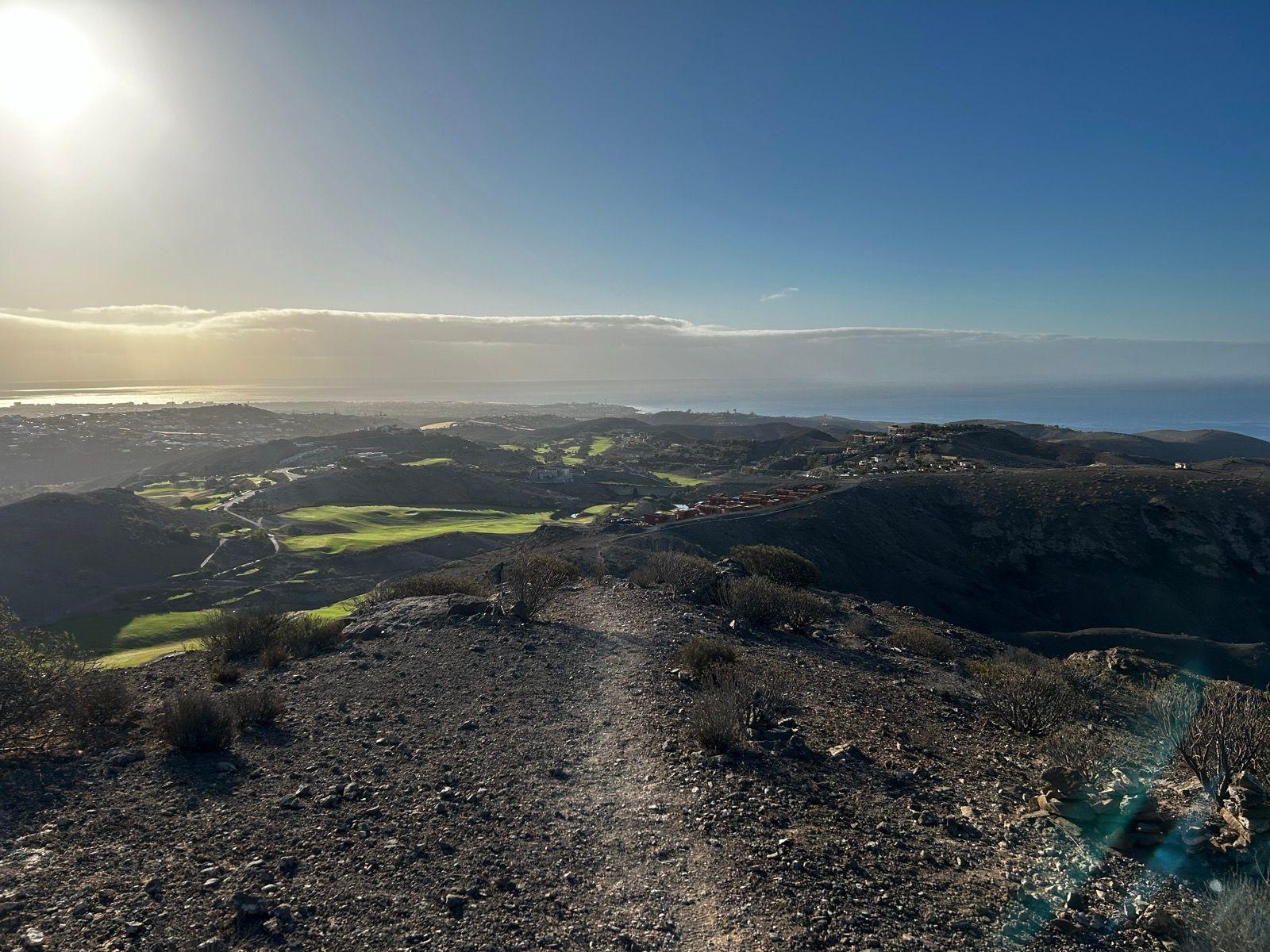
On (holiday) trips, trail running offers a chance to see and experience sides of the destination that the day's programme otherwise would not. A March half-term holiday in the Canaries with the family was a decent example: while the juniors were having their long lie-ins there was a chance to run 1-2h without the family's daily programme being disturbed in the slightest. The "geography" of the Canaries (Gran Canaria in this case) is favourable for this: the holiday resorts are mostly on or near the coast, and from them you can get out at least onto ridge formations running inland, or in some cases into the terrain around the resort as well. This time we stayed 3.5 km from the coast next to the El Salobre golf course, from where you could get into the terrain in almost any direction.
 The golf course's neighbourhood suits people other than the golfers too
The smooth-surface runner has an easy life: tie your laces and out onto the asphalt. The trail runner has to do a bit of work before heading out, but I would argue that the experiences you get more than cover that small effort. Time for route planning is easily found in those moments when the rest of the family is scrolling cat videos and whatever else FB, Insta & TikTok have on offer.
In Finland route planning has got easier year by year: in many areas the trails are now very comprehensively mapped into the OpenStreetMap community map (OSM), and with the Trailmap app it is easy to build a running route onto trails even in unfamiliar terrain. You can read more about this in an earlier piece.
In the Canaries both the tools and the methods had to change: besides the trails I had to think about the island's significant elevation, and instead of one app I ended up using three (Trailmap is not available outside Finland yet):
- Komoot and the openstreetmap.org website for viewing OSM trails: the area where we stayed was reasonably mapped, not as comprehensively as in Finland, but covering about 80% of the paths I ran
- Google Earth was the best tool for getting a sense of the landforms, and from it you could usually also see the wider trails / tractor paths that ran along the tops of the ridges
- Strava's global heatmap gave hints about where others had gone; with those I found a few trails that were missing from OSM and did not show clearly enough on Google Earth.
 Google Earth was the best for coming up with ideas
I also looked at ready-made routes in Komoot and Strava, but there was nothing there in the way of trails or roads that I had not already found in the above apps. In any case I very rarely run someone else's route as-is, so their value to me is usually pretty limited if a reasonable trail map is available. Googling did not get me a 100% certain answer on what kind of everyman's right (to move on other people's land) there is in the Canaries, but I came away with the impression that as long as there are no fences and clear "privada" signs, there should not be any trouble as long as you stay out of people's yards and the like, the same way as in Finland.
The first morning's route headed for the hills next to the villa, mainly to get to know the terrain and gauge how reliable the map was. As there were hardly any trees / vegetation, visibility was good and most of the 8 km / 260 m of climb run was based on route choices I made during the run. To get out of one dead end I looked for help from Strava's heatmap, which pointed to a very faintly visible path (not really even a trail) on a steep slope that I had not noticed as I ran past it.
The lesson from the first run was that route choices are limited more by the landforms than by whether there is a trail or not. Sure, a trail or tractor path worn flat is faster to run, but when needed, running was possible outside them in this terrain too. The ridge formations, the ravines between them and the steep walls in places instead dictated where it was sensible to go, or where I even dared to go (as someone with a fear of heights, my own limit ran at the spots where the price of a stumble would be serious injury or death).
The idea of the second morning run was to get from beside the El Salobre golf course to the coast and back. The big lines of the route were easiest to work out with Google Earth, basing them on the ridges leading towards the coast, on which I would also get across the GC-1 motorway. The changes between ridges and the details then came via Openstreetmap.org and Strava. I did not draw a precise route, because the ridges dictated the bulk of it and in the ground between them there were many options I believed I could pick from just fine once I saw what was on offer — an assumption that proved to work. There were no crowds on this 12 km run either; I met just one hiker near the coast, and otherwise had to settle for mountain bike tyre tracks that told me others do move on these trails from time to time.
 Fine views from the hills by the coast
The third morning run headed for the valley behind the golf course. The terrain there was harsh too, but greener than in the direction of the coast. The harsh terrain of the Canaries does not look all that inviting in the midday sun, but in the light of the morning and evening sun it thankfully looks more fascinating to someone used to northern greenery. In the valley I ran into some workmen out in a 4x4 who did not speak English (and I do not speak Spanish), but "privada" and "hotel" with a wave of the hand were plenty clear enough as instructions, and given in an entirely friendly spirit. I came up out of the valley by a different route than the one I went in by, and sure enough, that is where the fence and the privada signs turned out to be...
 The valley's slightly greener terrain
The idea of the fourth run was to head deeper inland (i.e. uphill) and see whether I could get a look at the big Arguineguín canyon from its rim (Barranco de Arguineguín) and come back to the accommodation along another ridge. The run went well up to the turning point, where I would have had to pass through a farm whose dogs started barking from hundreds of metres away while I was up on the slope. At least one of the dogs was in the front yard on the road, perhaps on a tether, but it was impossible to tell from a distance. I abandoned the plan to run through the yard even though the road through it looked more public than private. Getting to the rim of the canyon ran into a similar obstacle: a farmyard with its dogs and other animals. If the schedule had allowed, I could have tried going around these by climbing a couple of ridges without trails, but it was steep enough that the going would have been slow and uncertain — so that idea was scrapped. I also could not remember for certain whether there were other house yards to expect on the way back (along the originally planned route) — so the surest thing was to return the same way I had come, and the planned loop turned into a 15 km / 580 m out-n-back. On the way back I did try a shortcut along the edge of the area's biggest hill, but the steepness of the slope combined with loose gravel on top of rock made me do a U-turn.
The area around the fourth run's turning point was, incidentally, one of the few "ready-made" routes I found (this one from Komoot). With Komoot's routes it is not easy to say whether they are "planned" by Komoot's AI or actually walked by someone — either way, this only confirmed my earlier assumption that routes other than official & waymarked ones or ones from a reliable source are on a par with the trails on the map or Strava's heatmap traces, i.e. they do have information value, but you had better not trust them too much and it is best in any case to make your own route plan, because then you end up thinking through the different parts of the route, alternative paths included, in case for one reason or another you need or want to deviate from the planned route.
 On the way back from the hills
The trip's fifth run came as a bit of a surprise. Shortly before I had got my shoes on in the morning, my better half announced she was driving off to see the Maspalomas dunes — I said I would come along, and during the short drive I had to sketch out a route from the dunes back to the accommodation. Luckily I had already had a preliminary look at this direction too, so the idea quickly formed to potter about on the dunes for a while and then head uphill, partly along asphalt but largely on trails, of which the longest stretches ran along a "barranco" — a versatile term that can mean anything from a mighty canyon to a small, modest dried-up stream / river bed. In this case the route ran along the latter, which I knew of old to be mostly runnable, if slower than actual trails and tractor paths — dried-up beds are sand, rocks and grass, i.e. not a particularly rolling surface.
 Not quite the easiest running
 A barranco, i.e. a typical dry river bed
This post is meant as inspiration and tips for combining trail running with the rest of a holiday. If the main purpose of the trip is trail running or hiking, i.e. you get to choose your trails (and you drive to the trailheads), then it is worth digging into other sources, e.g. the route of the Transgrancanaria race, the waymarked hiking routes in the mountains and so on, so that you can pick your routes from GC's best trails.