
SUPPORT
trailmap
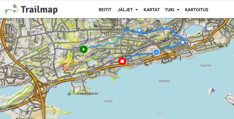
The Trailmap v2 web app makes use of the functional solutions proven good in the first Trailmap (originally "Bikemap") app, but the technical implementation of the app's interface has been rebuilt completely from scratch, while new functionality has also been added to the backend services supporting the interface. The upside of this is a considerably more advanced technical architecture, which makes developing new functionality significantly easier in future; the downside is the work required to implement the first version's functionality "again" on top of the new architecture.
At the moment (8 Oct 2023) Trailmap v2 is still missing a few of the first version's features; on the other hand it already has features that version 1.0 does not (and will not) have. The most significant new features already implemented:
- User accounts and with them the ability to save the user's own data, e.g. routes, independent of the device
- Custom maps: as in the "Trailmap Suomi" mobile app, the user can create and save their own maps
- Route planning is significantly more capable than before, taking lessons from the best features of BRouter, MapMyRide, Strava and Komoot among others
- Syncing routes to Garmin the same way as in Strava, say: click the "star" button next to a route and whenever the route is saved it is also synced to the Garmin Connect service, from where these days it also transfers automatically to connected Garmin devices (when they are synced with the GC service) — so you no longer have to go and do anything extra in Garmin Connect.
"Can't be bothered to read more, just give me the short version": see Trailmap v2 WOW.
On the goals
Trailmap v2's goal is to be the best map and route planning service for Finnish conditions for "all-terrain"-minded active outdoors people, whether the equipment is running shoes or a bike. The emphasis is especially on outdoors people who want to see and experience new scenery, trails, roads and routes.
There are already many quite good route planning services on the market, the most important benchmarks for Trailmap v2 being Strava, BRouter, Komoot, MapMyRide and RideWithGPS — but to my mind all of these benchmarks have essential shortcomings, and as global services they do not have features fitted specifically to Finnish conditions.
Trailmap v2 has been optimised for the active user's smooth and fast use, emphasising the features needed for demanding route planning.
So what does "demanding" route planning mean? First of all you could define it as the opposite of "simple" route planning: "simple" route planning emphasises speed & ease at the expense of other factors: a couple of clicks create some A-to-B or a loop route — which paths the route happens to follow is in the service's hands, not the route planner's. How well the service then manages to "guess" a route depends on the service: Strava's strength is its comprehensive "heatmap" database, which it uses to weight much-travelled paths; Komoot for its part visualises the mtb:scale tags of trails; BRouter has relatively versatile configuration of the routing profile; the other services then choose routes more or less on the "shortest is best" principle.
If you only ride asphalt on a bike, then most services work reasonably or well. If, on the other hand, you ride a mountain bike in the terrain, then only Komoot offers proper support for it. Gravel riding, trail running and other "all-terrain" forms of movement then sit between those two extremes.
In "demanding" route planning the aim is often to find a route that is out of the ordinary: not the most popular / biggest road or the most-ridden trail but something more challenging: certain trails instead of the most popular ones, forest roads, trails connecting the dead ends of forest roads, or the smaller and quieter of the car roads. Or you just want to ride some particular route, choosing the paths carefully: perhaps the paths have to be ones you have not ridden much before, or your own or others' earlier tracks serve as the reference, or the chosen paths have to meet certain criteria: the technicality of the trails, which hills you climb & which you descend, and so on.
Below are the most important shortcomings that Trailmap v2 offers, or will shortly offer, a solution to:
- Only Komoot offers a clear visualisation of the mountain bike classification of trails in its paid version (i.e. making use of the OSM mtb:scale tag)
- Only BRouter offers the ability to define your own maps; in the other services the map selection is narrow or very narrow: landforms (contour lines, hillshading), for instance, are barely supported. So making use of MML's maps or Digiroad's road database, for example, is not possible
- Likewise only BRouter offers the ability to load tracks onto the base map in a versatile way, either for viewing tracks or as a basis for your own route planning (NB! most services do offer the ability to view one earlier track at a time on the base map, but not simultaneously with route planning)
- In demanding route planning situations it is useful to quickly get information about the mapping of some OSM path: when it was created, what the tags are and the edit history
- A strong connection to mapping: fresh OSM data daily, smooth supplementary / corrective mapping straight from the app and other features aimed at mappers in particular
- Komoot's route planning interface is optimised for A-to-B type routing for beginner users, requiring a lot of mouse clicking to draw a route, which is frustrating especially in the sketching phase of a route where fluidly outlining different options matters
- Easy sharing of a route so that anyone can open it and navigate it without installing an app and without registering with the service
Of course each main benchmark also has particular strengths that Trailmap v2 does not have and could not even implement. To my mind there is therefore no single universally best map and route planning service; there are only different solutions with their own strengths.
Features in the works
I.e. what to expect in the near future...
- A route elevation profile and OSM path information view at the bottom of the screen, as in Strava, Komoot, BRouter and so on
- Route sharing as in the old Trailmap (the new data model requires a new backend service)
- Finishing the Google StreetView ("Pegman") integration
A bigger job is updating the "Trailmap Suomi" native mobile app to support user accounts; with that, routes will transfer directly between the web app and the mobile app.
Ideas being worked on
There is plenty ideated as new functionality on top of what is listed above, but the most interesting big chunks are the following:
- "Grailmap", i.e. stronger support for gravel riding. There seems to be a gap in what is on offer, which is why even services like Gravelmap (https://gravelmap.com), which to my mind are relatively poorly executed, enjoy users' favour
- P2P / "social media" — other enthusiasts' tips and knowledge are spread widely across different services: as pictures & routes on Strava, comments on Facebook, Gravelmap's "gravel" segments, Trailforks's "trail" descriptions and so on. This is of course a natural state of affairs in the internet's services, but I see an opportunity here to extend the activity that has grown up around OSM (+ Trailmap) trail mapping, where alongside OSM there would also be the possibility to map with pictures & descriptions, while still respecting OSM as the foundation (unlike, say, Gravelmap or Trailforks, which actively shun OSM) — this has to be made easy and fast while still preserving the quality of the content — notes, pics, segments